


We Still Object
Jun 13, 2021
WV Dept. of Environmental Protection intends to rubberstamp another mountaintop removal permit renewal on Coal River Mountain. This time it's the 2-square-mile Bee Tree site, inactive since 2014. If Bee Tree sounds familiar, it could be because this was the site where some of our friends sat in trees in January 2010 and August 2011, including a 30-day occupation. In addition to the carcinogenic blasting dust that this operation will send into its neighbors' lungs, it presents the added threat of blasting next to the Brushy Fork sludge dam.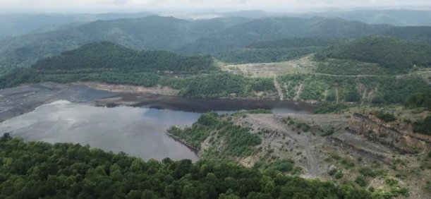 To object to renewal of the Bee Tree mountaintop removal permit, permit number S301004, you can comment on the online informal conference (public hearing) at 4PM, Thursday, June 17, at https://apps.dep.wv.gov/dmr/S301004. You can also call in to the conference at Phone number: # (681) 245-6817, Phone Conference ID # : 512 837 087#. Or you can email your objection by 5 PM, Friday, June 18, to Laura.B.Claypool@wv.gov. Be sure to state that you object to renewal of Permit Number S301004. Thanks!Holding over 7 billion gallons of toxic black coal preparation waste, Brushy Fork sits over abandoned underground mines. It was designed, built, and operated by Massey Energy, whose Martin County, KY, sludge dam burst through into abandoned underground mines in 1994 and again in 2000. That disaster released over 300 million gallons of black goo into tributaries of the Tug Fork and Big Sandy, affecting the water supplies for over 20,000 people and leaving a mess that will never be fully cleaned up. Massey's engineer has assured WVDEP that everything is perfectly safe at Brushy Fork. (Massey also assured their miners that the Upper Big Branch mine was safe before it exploded and killed 29 miners in 2010, but that's another disaster.)
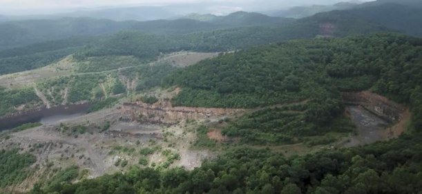 Coal River Mountain Watch objects to renewal of permit S301004 operated by former Massey Energy subsidiary Marfork Coal Company, now a subsidiary of Alpha Metallurgical Resources. You can also object. Include the permit number, S301004, in your objection by email to Laura.B.Claypool@wv.gov by Friday, June 18, at 5 PM. About a thousand acres of this site remain "undisturbed." The "mined and reclaimed" portion of the site, visible on the ridge on the other side of the sludge lake and shown in red on the map below, is nothing to brag about, and Alpha has withdrawn their phase 1 bond release application for this portion.
 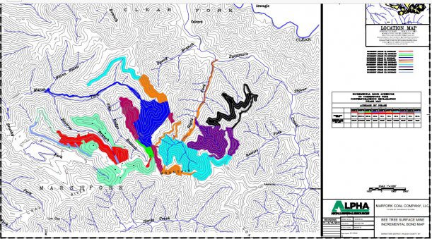 WVDEP is also holding an online "informal conference" (public hearing), where you can voice your objections, or you can ask questions of the WVDEP (at the beginning of the hearing), or you can just watch WVDEP go through their statutory motions before they give Alpha another five years to continue blasting this part of Coal River Mountain into dust. The link to the conference is at https://apps.dep.wv.gov/dmr/S301004. From WVDEP: The purpose of the informal conference is to allow comments from those people having an interest which is or may be adversely affected by the Marfork Coal Company, LLC Permit No. S301004, Permit Application Renewal No. 3, located southeast of Dorothy." We say that if you live on Earth, then you have an interest which is adversely affected. And if you care about the people downwind breathing the carcinogenic dust from this site, then you have an interest. And if you're concerned about the people downstream who could be inundated if Alpha's next disaster strikes Brushy Fork, then you have an interest.
On Friday, June 11, Coal River Mountain Watch's outreach coordinator Junior Walk flew a drone to get a view of Bee Tree and Brushy Fork. In spite of challenging weather and limited range, he got a good view of the mess. You can see the video at https://www.youtube.com/watch?v=2RmcGiX5TD4
And if you'd like to support our work, please consider a tax-deductible donation to Coal River Mountain Watch at https://secure.givelively.org/donate/coal-river-mountain-watch
Thanks for watching and objecting!
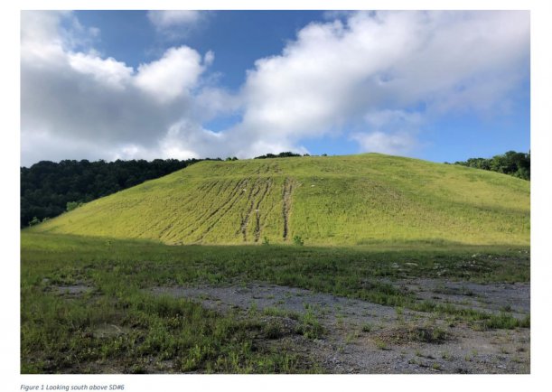
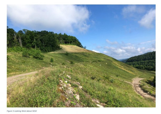
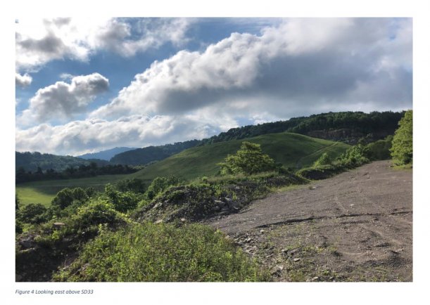
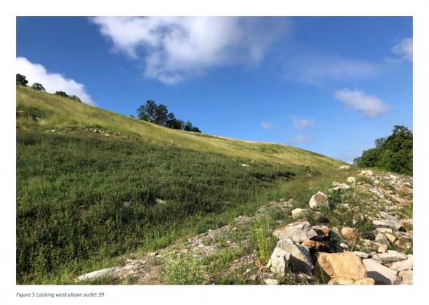
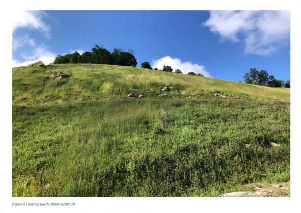
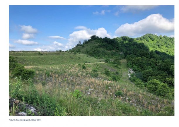
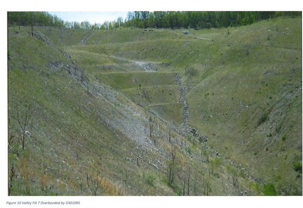
P.S. Here are some photos from the ground, just sent to us by WVDEP. This site has been "inactive" for 7 years, with only "reclamation" activity taking place. Note the gullies, rough ground up close, lack of trees, the lack of good photos of the "undisturbed" area, and no photos of the adjacent Brushy Fork sludge dam. We expect to have more photos and video the afternoon of June 16. Thanks again!